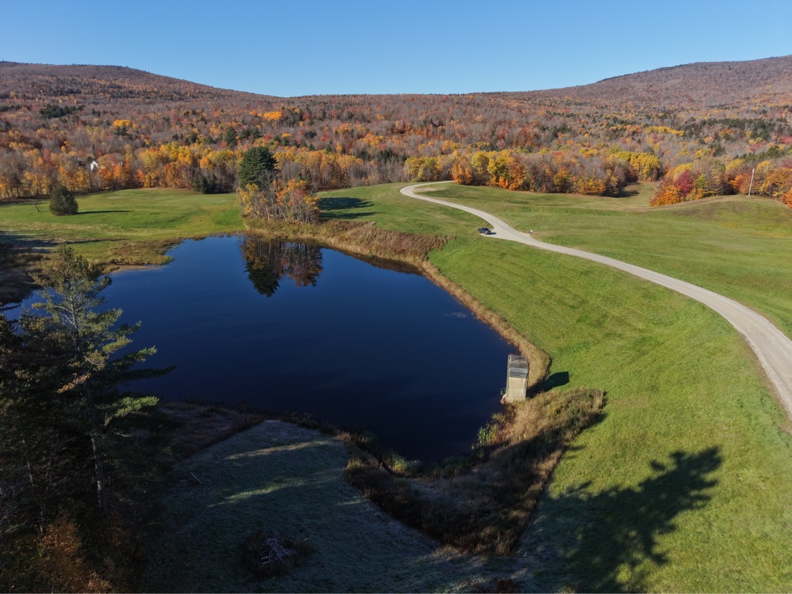
Most people drive right past them. Just west of Route 100, south and west of Ludlow village, four grass-covered earthen dams hold back four quiet ponds. On a map they carry plain names, Jewell Brook Site Number 1, 2, 3 and 5 Reservoirs, and that plainness hides what they do. When a heavy rain hits the steep ground around Terrible Mountain and the brooks start to rise, these dams are Ludlow's first line of defense.
A system, not a single dam
Jewell Brook is a small stream with an outsized reach. It gathers Grant Brook, Sanders Brook and other small drainages on the west side of Route 100 and delivers them to the Black River in the middle of Ludlow village. The Jewell Brook Watershed plan of 1964 set out to slow that water down. Built between the late 1960s and 1972 by the USDA, the dams are floodwater-retarding structures. In a storm they store water that would otherwise arrive downtown all at once, then release it gradually.
What July 2023 showed
On July 9-10, 2023, roughly six inches of rain fell on Ludlow in less than a day and the downtown flooded badly anyway, from the Black River as well as Jewell Brook. That is the limit of a system like this, and the reason for it at the same time. These four dams slow only the Jewell Brook side of town, they cannot hold back the Black River or a storm that size all at once, and flood control was never the same as flood-proof. What they do is buy time and take the sharpest edge off the first rush of water coming down the brooks toward the village.
Site One, the one on Route 100
Site 1, known locally as Site One, sits on Site 1 Road right on Route 100, about three miles south of the village. A short gravel road tops out on the crest of its 58-foot dam above a quiet 22.5-acre pond. There are no facilities and no signage to speak of. What there is: shore fishing in a pond that sees more herons than anglers, a walkable dam-top road, and mowed grass banks for a picnic. Site One is a stop in Vermont's Scenic Route 100 guide, at Scenic100.com, and on Green Mountain Guide.
Site 2, on Grant Brook
A short distance north, Site 2 holds back Grant Brook. Its dam is 70 feet high and 800 feet long, built in 1969, with a narrow 12.4-acre reservoir tucked into the trees. It is a working flood-control structure, not a park.
Site 3, the one everybody knows as West Hill
Site 3 is the exception in the system, and the only one built for two jobs. The West Hill Recreation Area, off West Hill Road on the west side of the village, pairs its 65-foot flood-control dam, built in 1970, with Ludlow's town recreation pond. People fish here. The pond is stocked annually with trout, and the grounds add basketball courts, a picnic pavilion, hiking trails, playing fields and a dog park. In winter the dam face is a popular local sledding hill.
Site 5, the tallest and the quietest
Site 5, finished in 1972 on Sanders Brook, is the tallest dam in the set at 113 feet, and the least visited. Its pond is small, under six acres, and like Sites 1 and 2 it has no developed recreation facilities.
Before you go
Visit Site 3 as a park, and Site 1 as a quiet roadside stop. Treat Sites 2 and 5 as infrastructure, enjoy them from public roads, respect any posted signs, and do not assume a reservoir on a map is a public swimming or boating place. Together, the four dams can store roughly 1,500 acre-feet of floodwater, water that is not in Main Street, in a shop doorway, or in the Black River at the worst possible moment.